Coimbra Map: How the City Is Laid Out
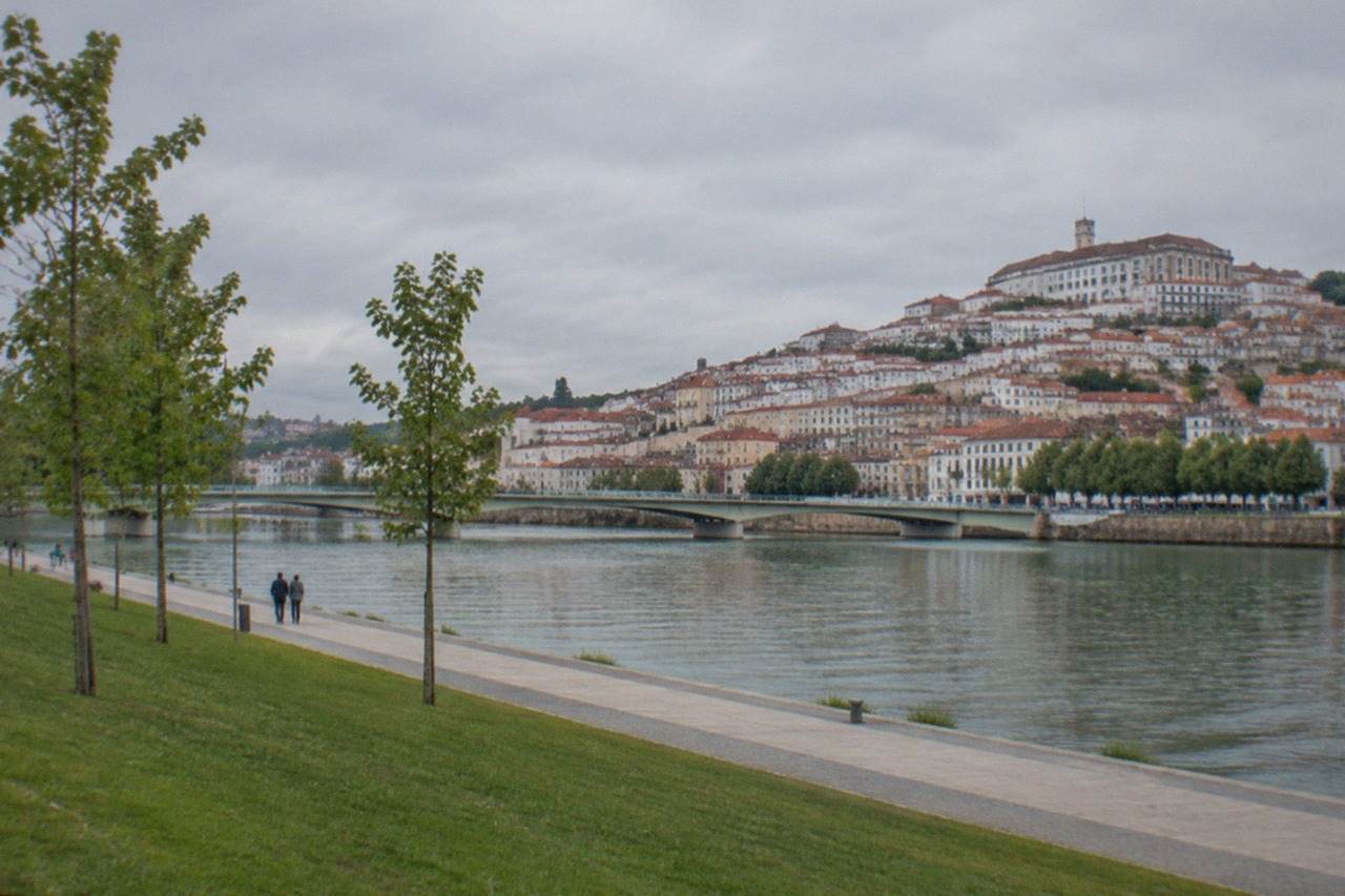
Coimbra, Portugal, the university city on the River Mondego, is a city of two levels: a steep university hill above and a riverside quarter below. This guide explains how the pieces fit together on the map.
Short answer
Coimbra splits into the Alta, the UNESCO-inscribed university hill, and the Baixa, the commercial riverside low town, with the River Mondego separating the historic core from the Santa Clara side. Two train stations, Coimbra-B and Coimbra-A, sit in different places, and a shared SMTUC and Metro Mondego ticket covers buses and the new Metrobus network.
Coimbra, Portugal, the university city on the River Mondego, is easier to understand as a map than as a list of sights, because almost everything a visitor comes for sits on one steep hill and the riverside strip directly below it. The city is a city, a municipality and a district, and the three are different things: the district reaches the Atlantic and contains Figueira da Foz, while the city itself never touches the sea. This page walks through the layout level by level, from the university hill at the top to the river at the bottom, then outwards to the stations, the bus network and the day trips that surround the city on a regional map.
How Is Coimbra, Portugal, Laid Out on a Map?
Coimbra is built on two levels: the Alta, the university hill that holds the Paço das Escolas, the Biblioteca Joanina and the Sé Velha, and the Baixa, the commercial low town that runs down to the River Mondego. The river then separates the historic core from the Santa Clara quarter on the far bank. UNESCO's 2013 inscription, "University of Coimbra – Alta and Sofia", list reference 1387, covers the university hill and the college street, not the whole city.
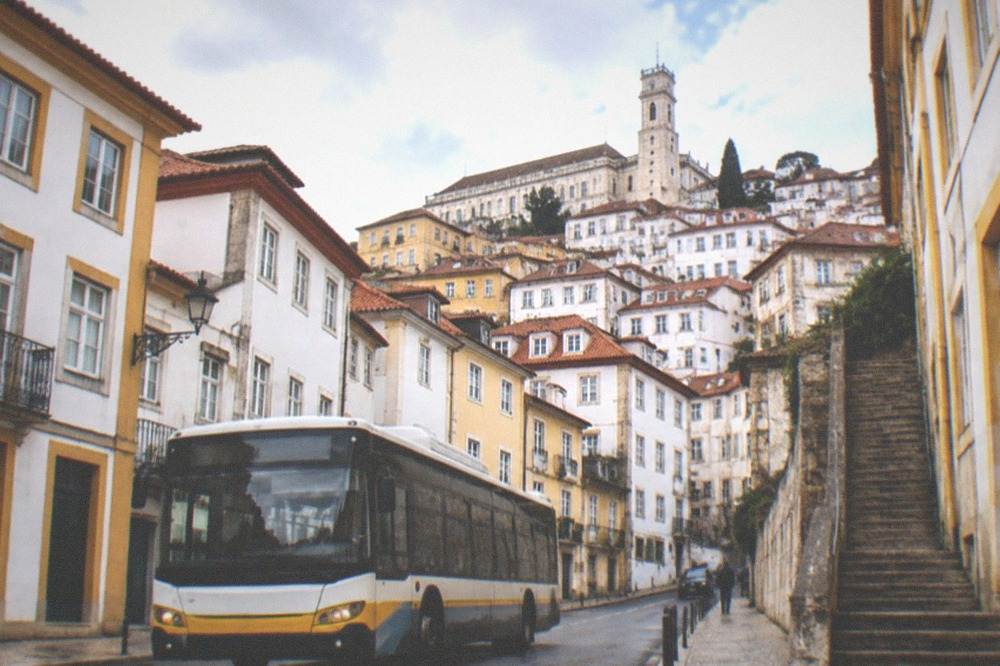
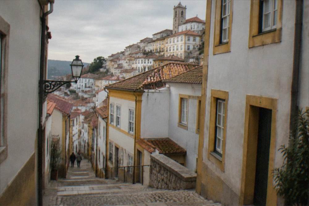
The Alta is the high ground. Everything up there involves climbing: the University of Coimbra's Paço das Escolas, the Joanina Library, the Capela de São Miguel and the old cathedral, the Sé Velha, all sit on or near the crest of the hill. The Baixa, the low town, is the grid of streets around the Praça do Comércio and the Arco de Almedina, and it is where most of the shops, cafés and the municipal market sit. The Arco de Almedina is the historic gate between the two levels, and the streets through it are steep.
Below the Baixa, the River Mondego runs west to east through the city, and on the far bank sits the Santa Clara district, where the Portugal dos Pequenitos theme park and the old monastery ruins are found. The Parque Verde do Mondego, the riverside park, lines the near bank and is the flattest walking in the city.
The vertical geography matters for planning. A day that starts at the river and works upward means the climb happens once, in the cool of the morning. A day that starts at the top means everything after lunch is downhill. There is no funicular or lift that connects the Baixa to the Alta directly; the Elevador do Mercado connects the riverside market area to the upper part of the Baixa, but the last stretch to the university is on foot, up steep streets. The Coimbra Travel Guide walking routes page covers this in more detail, and the self-guided walking tour guide gives a full day-by-foot route.
A useful mental map of the core, with the verified ticket prices attached:
| Zone | What sits there | Ticket price (adult, verified) |
|---|---|---|
| Alta (university hill) | Paço das Escolas, Biblioteca Joanina, Capela de São Miguel, Chemistry Laboratory | 16.50 EUR combined ticket with Joanina, 12.50 EUR without |
| Alta (below the Paço) | Sé Velha de Coimbra | 3.00 EUR individual |
| Baixa (low town) | Praça do Comércio, Arco de Almedina, Mosteiro de Santa Cruz | Santa Cruz 5.00 EUR individual |
| Far bank (Santa Clara) | Portugal dos Pequenitos, Santa Clara-a-Velha | Pequenitos price on the venue's own ticket page; Santa Clara-a-Velha currently closed for works |
What Does the Alta Look Like on a Coimbra Map?
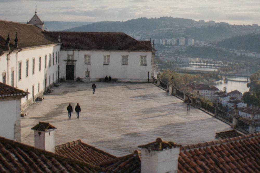
The Alta is a compact cluster around the Paço das Escolas, the university's ceremonial courtyard, with the Biblioteca Joanina inside it, the Capela de São Miguel beside it and the clock tower, the Torre da Universidade, above it. The University's own visit pages state the tower is closed to the public, so no route should plan on climbing it. The Joanina admits 50 people every 20 minutes and cannot be bought on its own, only inside the 16.50 EUR combined ticket.
Everything in that cluster is within a few minutes' walk of everything else, but the timing rule is strict. The date and time printed on the combined ticket is the Joanina slot specifically, the other spaces can be visited over two days, and entry outside the printed slot is refused, in the University's own published wording. Online purchase closes 20 minutes before the visit time. That 50-per-20-minutes ceiling is the one genuine scarcity fact in the city, and it is why the Joanina should be the first thing booked, before any restaurant or hotel.
The University publishes about 31,000 students on its own "University in Numbers" block, which explains why the hill feels like a working campus rather than a museum. The closing dates in the current cycle are 24 and 25 December 2026, 31 December 2026 and 1 January 2027, 24 May and 4 October, and the University also warns that academic and religious ceremonies interrupt the tourist circuit without much notice.
The full ticket structure, from the University's own program list, valid for 2026:
| University ticket | Adult price | What it includes |
|---|---|---|
| Joanina Library + University + Science Museum | 16.50 EUR | Joanina, Royal Palace, St Michael's Chapel, Chemistry Laboratory, Academic Museum, Cabinet of Curiosities, Mineral Gallery |
| University + Science Museum | 12.50 EUR | The same list without the Joanina |
| Guided tour, Palace of Schools | 25.00 EUR | Guide-led, 1h30, Science Museum spaces not included |
| Science Museum + UC Exploratório | 16.00 EUR | Science spaces only, no Palace of Schools |
| Guided tour, Botanical Garden | 10.00 EUR | 1h30, meets at the garden's side entrance |
The Botanical Garden sits on the Alta's western slope and is worth marking on the map as the quiet corner of the hill. The university tickets guide and the Joanina Library tickets guide cover the booking mechanics in depth.
A guided walk is one way to cover the hill without doing the route-finding yourself. The Coimbra Top Attractions Walking Tour runs from $5.85 per person, is rated 5 from 151 reviews, and takes 2 hours 30 minutes, which makes it the cheapest structured way to put the whole map in order on a first day.
Where Is Everything in the Baixa and Along the River?
The Baixa is the grid of streets between the Arco de Almedina and the River Mondego, centred on the Praça do Comércio, with the Mosteiro de Santa Cruz, the burial church of Portugal's first two kings, on its eastern edge at 5.00 EUR adult admission. The riverside Parque Verde do Mondego runs along the near bank, and Portugal dos Pequenitos sits across the river in Santa Clara, open 10:00 to 19:00 from 1 March to 15 October.
The Baixa is flat, which makes it the natural second half of any day that spends its morning climbing. Santa Cruz is the one monument in the low town with a paid visitable interior: the Unidade Pastoral Aeminium, which runs it, lists 09:30 to 16:30 visiting hours, with Sundays and religious holidays on a separate schedule, and visits suspended on Easter Sunday and on the Cortejo da Queima das Fitas, a moveable Sunday in May.
Two major sites should be marked on the map with a caveat rather than a price. The Museu Nacional de Machado de Castro, which sits above a Roman cryptoporticus of the mid-1st century on the edge of the Alta, is closed for conservation work; the museum's own page says so, and no reopening price has been published on an official page. The Mosteiro de Santa Clara-a-Velha, across the river, has been closed for requalification works since October 2025 and has no price or hours that can be published here. Check both with the national Museus e Monumentos portal before planning a visit.
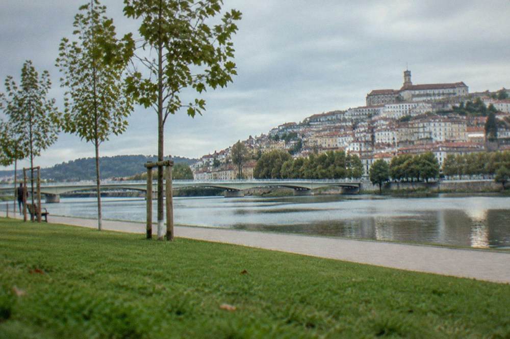
The river itself is a map feature in its own right. Boat trips run from the near bank, and the Parque Verde do Mondego guide covers the riverside park. On the far bank, Portugal dos Pequenitos, the miniature village designed by Cassiano Branco and opened in 1940, publishes its hours on its own horário page: 10:00 to 17:00 in the winter period and 10:00 to 19:00 from 1 March to 15 October, closed Christmas Day. Its price page renders client-side, so the current figures live on the venue's own ticket page rather than in any guide.
A status table for the major mapped sites, as of the current research pass:
| Site | Map position | Status | Verified price |
|---|---|---|---|
| Paço das Escolas and Joanina | Alta, hilltop | Open, timed Joanina slots | 16.50 EUR combined |
| Sé Velha de Coimbra | Alta, below the Paço | Open | 3.00 EUR |
| Mosteiro de Santa Cruz | Baixa, eastern edge | Open, closes for the Cortejo Sunday | 5.00 EUR |
| Museu Nacional de Machado de Castro | Edge of the Alta | Closed for conservation work | None published |
| Torre da Universidade | Alta, above the Paço | Closed, per the University's own page | No ticket exists |
| Mosteiro de Santa Clara-a-Velha | Far bank, Santa Clara | Closed for works | None published |
| Portugal dos Pequenitos | Far bank, Santa Clara | Open | On the venue's own ticket page |
How Do the Two Train Stations Sit on a Coimbra Map?
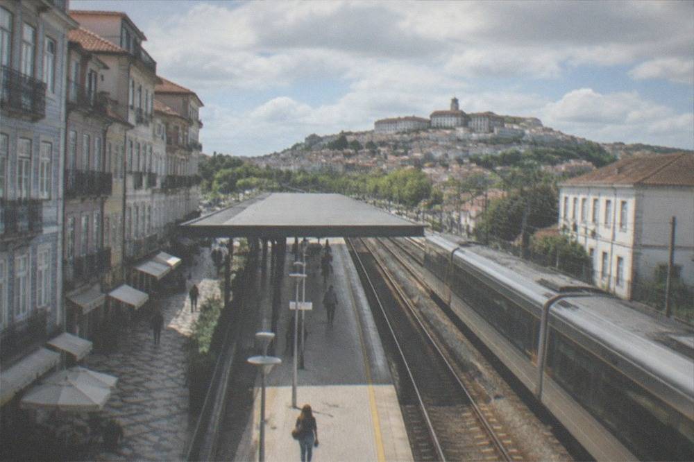
Coimbra has two stations with confusingly similar names: Coimbra-B, which sits on the main line away from the historic centre, and Coimbra-A, which is the station closest to the Baixa and the old town. They are in different places on the map, and CP, the national rail operator, is where to check which trains call at which. The specifics of the shuttle between them are not published in a form this site can verify.
This is the single most practical map question for anyone arriving by train, and it is the one most often answered wrongly. What can be said with confidence: two stations exist, they are in different places, and the long-distance and local services do not all serve both. What cannot: whether the short connecting run between them is free with a long-distance ticket, because CP's own pages do not confirm it in a verifiable way. The train stations A and B guide is the dedicated page, and the Lisbon to Coimbra and Porto to Coimbra guides cover the approaches from each end of the country.
How do You Get Around Coimbra Without a Car?
SMTUC city buses are the local network, and the 2026 tariff, in force since 1 April, lists a driver ticket bought on board at 2.00 EUR and pre-purchased trips at 0.90 EUR each in packs of three or more, with one trip valid 90 minutes including transfers. The same tariff sells titles valid on both SMTUC and the Metro Mondego network, so a bus ticket also works on the new Metrobus. A single-ride price for the Elevador do Mercado is not published.
The Metro Mondego is a bus-rapid-transit system opening in stages, and its route-by-route detail is not yet published in a form this site can verify. What the SMTUC tariff does confirm, in its own heading, is that intermodal titles are "válido na rede SMTUC e Metro Mondego", which is the practical fact a visitor needs: one ticket system covers both. Day passes exist for one, three and seven days, but the tariff PDF lays its price grid out in a way this build could not map to rows with confidence, so check the operator's own tariff for the current day-pass figures.
| SMTUC ticket type | Price | Notes |
|---|---|---|
| Driver ticket, on board | 2.00 EUR | Single trip |
| Pre-purchased, 3+ trips | 0.90 EUR per trip | Rechargeable card |
| Trip validity | 90 minutes | Transfers included on the urban network |
| MOVE-C support card | 3.00 EUR youth, 6.00 EUR others | One-off card cost |
| Fare evasion fine | 120.00 to 350.00 EUR | Published in the same tariff |
Walking remains the main way through the historic core, because the streets of the Alta are narrow and steep and the grid of the Baixa is compact. The getting around guide covers the full picture, and the car rental guide is the page for anyone deciding whether a car is worth it for the day trips. For most visitors staying in the centre, a car is more hindrance than help: the city's layout is a hill and a river, and both are best crossed on foot or by bus.
Where Do the Day Trips Sit on a Regional Map of Coimbra?
The main day trips from Coimbra sit in a ring around the city: Conímbriga, the Roman town, roughly 16 km south in the parish of Condeixa-a-Velha in the municipality of Condeixa-a-Nova; the Schist Villages of the Serra da Lousã to the southeast; the Buçaco forest to the north; Fátima to the north; and Tomar to the northeast. Conímbriga's museum and ruins share one 10.00 EUR adult ticket and are open daily 10:00 to 18:00.
Conímbriga is the easiest to place: due south, close enough that tours run there in half a day. The site is in Condeixa-a-Nova municipality, not in Coimbra, a distinction writers get wrong in both directions. The Museu Nacional de Conímbriga's own pages list the combined 10.00 EUR ticket, daily hours and a ticket office that closes at 17:15, closed on 1 January, Easter Sunday, 1 May, 24 July and 25 December. Being open seven days a week makes it the reliable Monday option when other national monuments shut.
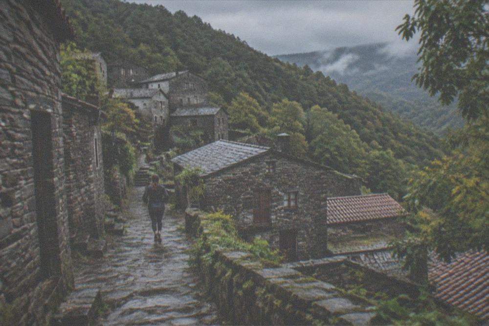
The Schist Villages are the mountain option, southeast in the Serra da Lousã, and they are where the map changes character entirely: stone villages on forested slopes, an hour or so of winding road out of the city. The schist villages guide and the Lousã day trip guide cover them, and the day trips guide gives the full regional picture.
The tour options that cover the ring around the city, all from the current roster:
| Day trip tour | Direction from Coimbra | Duration | From (per person) |
|---|---|---|---|
| Conimbriga and The Roman Tour | South, ~16 km | 4 hours | $105.37 |
| Schist Villages at Lousa Mountain | Southeast, Serra da Lousã | 4 hours | $105.37 |
| An adventure through the Forest and Palace of Bussaco | North, Buçaco | 4 hours | $87.81 |
| Fátima Private Tour: Shrine, Sacred Way & Shepherds' Hometown | North, Fátima | 3 hours | $129.95 |
| Time travel at the Convent of Christ Tomar | Northeast, Tomar | 1 to 3 hours | $46.83 |
| Soft Canyoning, river Ceira, Góis, Serra da Lousa | South, river Ceira | 4 hours 30 minutes | $58.54 |
For the Roman ruins specifically, the Conímbriga and The Roman Tour runs four hours from $105.37 per person, rated 4.8 from 136 reviews, or Check availability for current dates. For the mountain southeast of the city, puts the Serra da Lousã on the itinerary as a canyoning day on the river Ceira.
How Does the Weather Map Onto the City's Year?
IPMA's 1991 to 2020 normals for the Coimbra / Bencanta station, the city's own station 3 km from the centre, show a dry, hot summer and an autumn-winter wet season: July averages just 8.9 mm of rain, August is the hottest month at a 29.1 C mean maximum, and November is the wettest at 121.5 mm. September is hotter than June, 27.4 C against 26.3 C, and still dry at 49.9 mm.
This matters for the map because the city's layout is vertical: the climb to the Alta is a different proposition at 29 C than at 20 C. August averages 10.9 days above 30 C at the station, and the record maximum there is 41.2 C, set on 7 August 2016. Winter is mild rather than cold, with January mean maxima of 15 C, though the record minimum is -4.3 C from 20 January 2017. The rain holds off until October, when the monthly total jumps from September's 49.9 mm to 114.5 mm.
| Month | Mean max C | Rain mm | Days 30 C+ | Map-planning note |
|---|---|---|---|---|
| March | 19.1 | 75.4 | 0 | Comfortable climbing weather |
| June | 26.3 | 26.0 | 6.2 | Dry, warm, busy |
| July | 28.5 | 8.9 | 8.9 | Effectively dry, hot afternoons |
| August | 29.1 | 14.8 | 10.9 | Hottest month, climb early |
| September | 27.4 | 49.9 | 7.8 | Hotter than June, crowds gone |
| October | 23.2 | 114.5 | 2.0 | The autumn rain arrives |
| November | 18.0 | 121.5 | 0 | Wettest month |
The weather guide and the best time to visit guide expand on this month by month. The short version for route planning: do the Alta in the morning in summer, keep the Baixa and the riverside for the afternoon, and treat October to January as months where an indoor backup, a fado show or a museum, belongs on the itinerary.
What Else Should You Mark on a Coimbra Map Before You Go?
Three practical things belong on the map before arrival: the 1.00 EUR per-night municipal tourist tax, capped at three consecutive nights and payable at the accommodation, which the municipality reported 698,151 overnight stays in 2025; the May student festival period, when the University closes its visitor circuit on 24 May and Santa Cruz suspends visits on the Cortejo Sunday; and the fado houses of the Baixa, where the city's own sung tradition is performed.
The tourist tax is small but universal: 1.00 EUR per guest per overnight stay, from age 16, paid to the accommodation at check-in or check-out, in force since 5 April 2023. The municipality's own economic study put its annual tourism-related cost at 2.44 million EUR, or 3.49 EUR per overnight stay, which is why a rise to 2.00 EUR was proposed in July 2026; until the municipality's own tax pages say two, the current figure is one. A couple staying seven nights pays 3.00 EUR each, in the municipality's own worked example.
The May closures are the other thing a map needs. The Queima das Fitas, the student festival, falls in May, and while its exact dates are published by the Associação Académica rather than by any source this site can verify, two hard facts stand: the University closes its visitor circuit on 24 May, and Mosteiro de Santa Cruz suspends visits on the Cortejo Sunday. Anyone planning a May visit should book the Joanina slot with those dates in mind. The Queima das Fitas guide covers the festival in full.
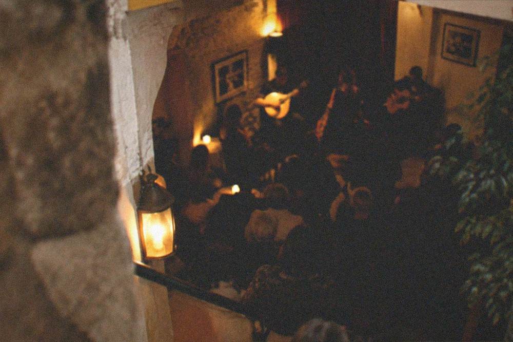
Fado belongs on the evening map. Coimbra's fado is its own tradition, tied to the student culture of the university, and the fado de Coimbra guide and the where to hear fado guide map the venues. A live show with a glass of port wine runs from $18 per person, rated 4.7 from 1,234 reviews, in 50 minutes, which slots neatly into an evening after a day on the hill.
For a fuller run through the whole city, covers the top attractions on foot, and the what to see guide and the attractions guide give the complete sight list with the map positions filled in.
Common Questions About the Coimbra Map
Is Coimbra, Portugal walkable from one end to the other?
The historic core is compact and walkable, but it is vertical: the Alta sits on a steep hill above the Baixa, and the climb between them is on foot. The Baixa and the riverside are flat. The city's core can be crossed on foot in under an hour, with the climb to the university the only strenuous part.
Is Coimbra a UNESCO World Heritage city?
No. UNESCO inscribed "University of Coimbra – Alta and Sofia" in 2013, list reference 1387, covering the university hill and the Rua da Sofia college street. The inscription is two components inside the old town, not the whole city, and saying otherwise is the most common error in guides to Coimbra.
Which Coimbra train station is closer to the old town?
Coimbra-A is the station nearest the centre and the Baixa; Coimbra-B sits on the main line further out. Which trains call at which station should be checked with CP, the national operator, because the stopping patterns are not published in a form this site can verify.
Does a Coimbra bus ticket work on the Metro Mondego?
Yes. The SMTUC 2026 tariff sells intermodal titles explicitly marked valid on both the SMTUC network and the Metro Mondego network, so the same ticket covers city buses and the new Metrobus.
What is across the river from central Coimbra?
The Santa Clara district, holding Portugal dos Pequenitos, the miniature village opened in 1940, and the Mosteiro de Santa Clara-a-Velha, which has been closed for requalification works since October 2025. The riverside Parque Verde do Mondego lines the near bank.
Can you climb the university clock tower in Coimbra?
No. The University's own information page states the Torre da Universidade is closed, and there is no ticket for it. The Joanina Library, the Capela de São Miguel and the Paço das Escolas are the visitable spaces on the hill, inside the 16.50 EUR combined ticket.
The map of Coimbra is ultimately a simple one: a hill, a low town, a river, and a ring of mountains and Roman stones around the outside, all close enough that a well-planned day can touch every level of it.